Observing Methane at High Latitudes
Published on: May 28, 2025
Data Dispatch Series
Data Dispatches are regular communications highlighting insights and information from the Carbon Mapper data portal. We believe transparency is critical in advancing global efforts to mitigate methane. That’s why Carbon Mapper is committed to delivering accessible methane and CO2 data so that it can be used by policymakers, regulators, operators, and civil society to guide science-based actions to reduce emissions.
What methane emissions we see using Tanager observations from high latitudes
Multiple plumes of methane have been detected by Tanager-1 at extremely high latitudes including the plumes we feature here in Russia and Canada.
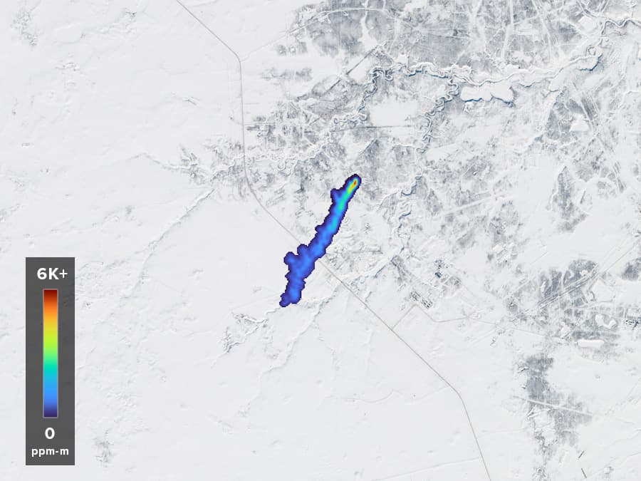
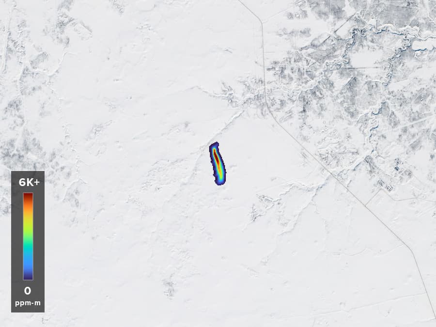
In Russia, as shown below, Tanager-1 detected methane in Purpe, Yamalo-Nenets Autonomous Okrug, Russia, an area located at a latitude of 64.478° N. Carbon Mapper quantified these plumes and attributed them to oil and gas production facilities.
In Canada, methane plumes from coal mining operations were initially observed by Tanager-1 on February 15, 2025 over Elkford British Columbia, Canada at a latitude of 50.0246 degrees N. These plumes are not yet quantified.
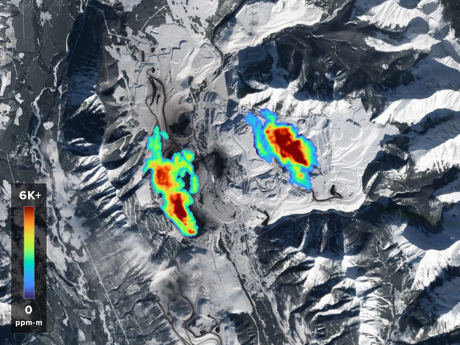
Methane plumes from coal mining operations were initially observed by Tanager-1 on February 15, 2025 over Elkford British Columbia, Canada. These plumes are not yet quantified. (Plume IDs: Left: tan20250215t185837c00s4001-B | Right: tan20250215t185837c00s4001-A) Basemap credit: Planet
Why this methane emissions data matters
This reveals new high-latitude detection capabilities that are enabling a unique look into methane emissions in regions where public methane emissions data was previously not available due to technological limitations.
Many emissions-sensing satellites use sunlight to observe methane (to learn more, see our educational blog on imaging spectroscopy which is one method of detecting methane). Therefore, satellite observations of emissions from high latitude regions have traditionally been a challenge due to factors like low sun angles, persistent cloud cover, and significant snow cover in winter seasons.
Early in the satellite’s commissioning period, Tanager-1 successfully detected several high latitude plumes in areas of high snow cover such as Russia and Canada, as shown in these examples. Since that time it has detected hundreds of emissions events in high latitude regions, and Carbon Mapper has made these plumes available on our public portal.
This is an exciting development in bringing new emissions transparency to previously ‘unobservable’ areas with high granularity. New and increasing volumes of methane data can raise societal awareness on the exact sources of emissions — intelligence that is critical to mitigating them.
Learn more about methane super-emitter data
Visit our data portal to learn more, and use the filter function to search plumes by geography and/or observing instrument.
In addition, you can utilize our new ‘saved search’ functionality to set alerts when plumes are added according to specified search terms.